

On a hot summer day in mid-July, we decided to go to the Swiss Alps. The goal of the day hike was Mount Pizol and its classic five-lake route.
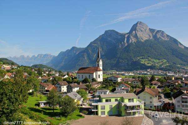
Pizol is located in the canton of St. Gallen, approximately 120 km from Zurich. It's a high mountain range, with an altitude of 2,844 meters. In winter, it's a ski resort, and in summer, it's a wonderful place for hiking with magnificent views. Today, I invite you to explore the Alpine lakes and the stunning Swiss countryside.
We leave home early... 200 km to our destination... it took us almost three hours to drive.
Not the entire route was on these autobahns; in some places we drove through Swiss villages.

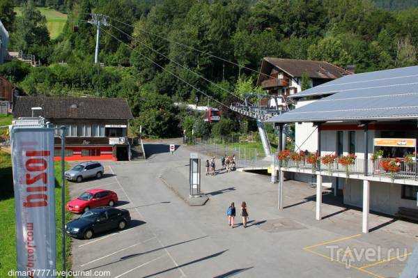
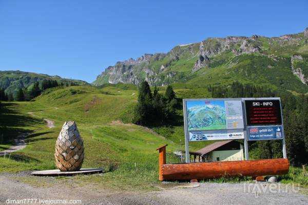
The ski lift to the mountain is located in the village of Vilters-Wangs (510 meters above sea level). The air temperature was around 30 degrees Celsius.
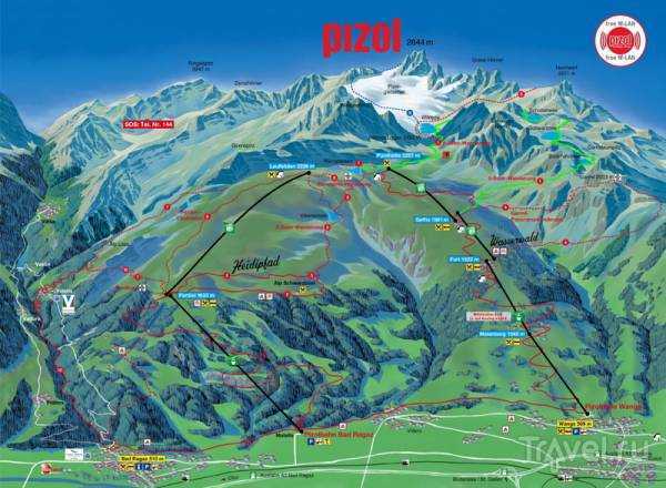
I suggest you look at the map to see what our route looked like. We took three lifts from the Pizolbahn Wangs station to Pizzolhütte. The green trail is our route through the mountains and lakes to the second station, Gaffia. Our total walk time was seven hours…
The first cable car station, Pizolbahn Wangs. A roundtrip ticket per person cost 40 francs, which I think is about 35 euros…
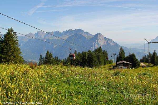
We're going up...
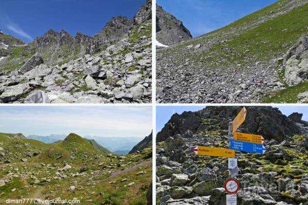
There's a short walk between the lifts. There's an information board with the various routes… and there are a lot of them…
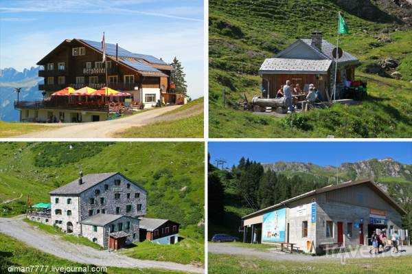
There are several mountain hotels for those planning a couple of days' hike, and we're heading to the second station, which is an already open four-seater chairlift...
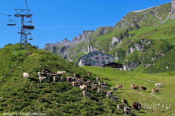
We continue to move upwards, with a herd of mountain cows below us…
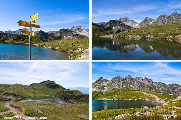
This is what the lifts and the third station look like. There are signs everywhere, so it's pretty hard to get lost here…
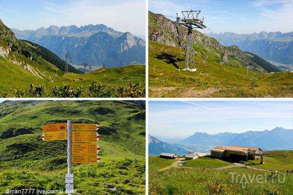
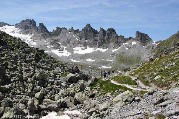
We climbed to the very top, to Pizzolhütte, at 2,227 meters above sea level, with a temperature of 16 degrees Celsius. The first lake, Wangsersee, is a five-minute walk away.
We walked around the lake...
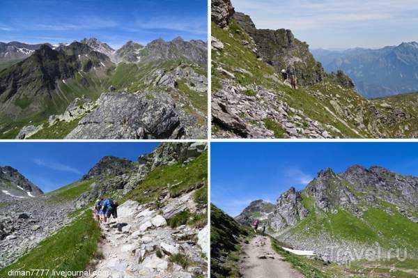
We continue along the path that will lead us between the rocks...
There were quite a lot of tourists on this Saturday...
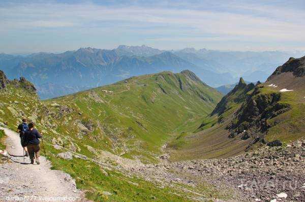
I look back... there, somewhere in the distance, the first lake and the ski lift station remain...
Let's move on...
What do you think people are looking at so intently there?
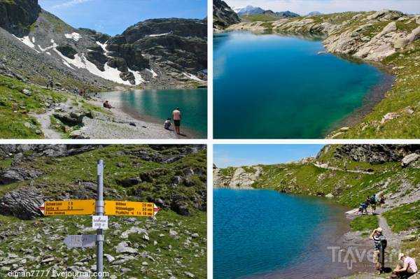
And they look at the second lake, Wildsee, which is 2,438 meters above sea level... in the distance, you can see the Pizol glacier... you can also walk there, but some other time...
We walk along the lake...

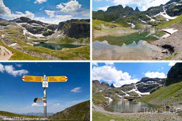
From the top, a view opens up onto the third lake, Schottensee. Now it's time to descend...
There were daredevils who swam in the icy water...

Lake Schottensee, 2,335 metres above sea level…

And we move on and admire the beautiful views...
Mountain trails:)

We descend to the fourth lake, Schwarzsee, 2372 meters above sea level.
Schwarzsee
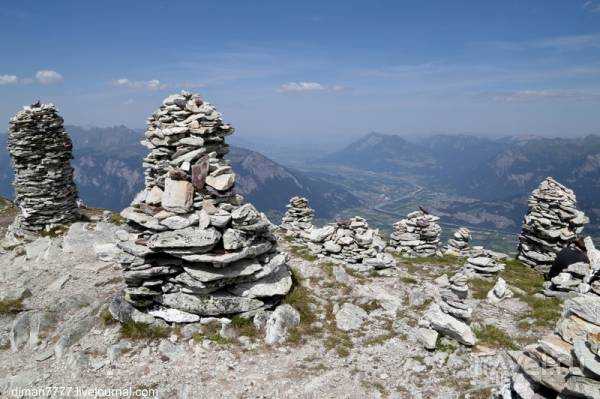
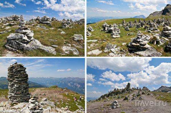
We move on and notice these interesting stone structures...
You stand on the cliff, and the sensations are simply incredible...

And the views are beautiful... the Rhein River... to the right, beyond the river, is the Principality of Liechtenstein

View from above of the fifth lake, Baschalvasee, as we descend towards it…
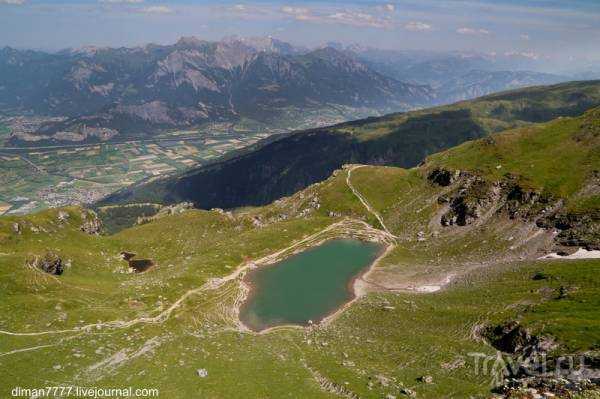

Baschalvasee is 2174 meters above sea level, depending on the light the water changes its color and takes on beautiful shades...
And we're heading to the ski lift... along the way we come across mountain cows


After a long walk, you can finally relax as you go down on the lift…

That's where our walk ends. We're left with a lot of pleasant emotions and several gigabytes of photos. :)
I hope you enjoyed it too, thanks for your attention!
Source: travel.ru