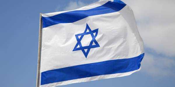
Let's face it, visiting Gibraltar has always been a fantastic idea. Yes, it's in Europe; and at the same time, more than any other place, it feels like the edge of Europe. If I were to post just this photo and ask where exactly I was talking about, probably not everyone would immediately guess! In any case, I've never seen this flag.

In general, the first views of Gibraltar look something like this. It is not for nothing that it is simply called The Rock - it really does look like some kind of gigantic geological misunderstanding that some wizard installed on the flat southern coast of Spain. This photo was taken after crossing the border.

In general, I stayed in the town of La Linea de Concepción, which is directly adjacent to Gibraltar from the north. The thing is that in Gibraltar itself there are literally five hotels and they cost crazy money. While La Linea is simply full of cheap hotels - I stayed in a perfectly decent place for 22 euros. Since you can easily walk to Gibraltar from La Linea, I did not see much point in staying in Gibraltar itself. Crossing the border in Gibraltar (with my passport) was elementary. The only thing to note is that it makes sense to change money only on the Spanish side - in Gibraltar itself the exchange rate at exchange offices is absolutely extortionate. As you understand, since Gibraltar still belongs to Great Britain, pounds are used here. Gibraltar does have the right to print its own coin – its own pound – which is rather inconvenient because Gibraltar coins are not accepted in the UK, so you have to get rid of them before leaving Gibraltar. I bought £10 at the border, but then realised that even that was unnecessary – because in Gibraltar you can pay by card everywhere.
This is what the border looks like from a high point on the Gibraltar side. Here you can see La Linea, then in the center of the photo the border and all the buildings associated with it, then the runway of the Gibraltar airport goes horizontally and then Gibraltar itself begins. After crossing the border, you can simply walk across the runway - or take a bus.

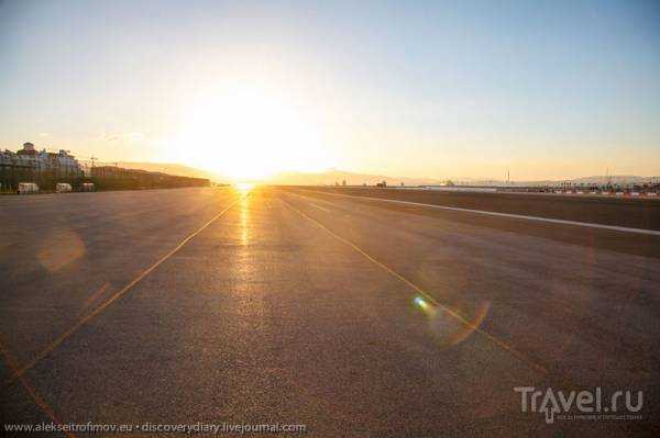
On the way back I decided to walk across the runway. It's pretty funny - there are traffic lights, so it's like crossing a normal road. You can also see the sun setting in the west.
An alternative is to take a bus that stops after the border and takes you to the center of Gibraltar. This is what I did this morning - as it was included in my pre-purchased ticket for the funicular. I also definitely recommend doing this if you visit Gibraltar. You can buy a ticket for the funicular on the Spanish side before crossing the border. The main bonus of this is that you don't have to stand in line to buy a ticket directly at the funicular - which can take an hour and a half.

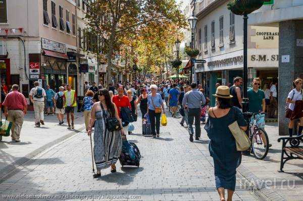
This is what Gibraltar's main street, Main Street, looks like. Everything there is so British.
The main square, Casemates Square, is where preparations are underway for some kind of ceremonial event.

The Governor's residence.

At the end of Main Street there is a gate like this in the wall built by Charles V - that is, when Gibraltar was still Spanish. The Spanish still cannot forgive themselves for losing Gibraltar.

Perhaps the main attraction of Gibraltar is the Rock itself, which you can of course walk to, but it is much easier and faster to go there by cable car. I chose the option to climb up by cable car and go down on foot. View of Gibraltar from the cabin (we are looking north).
Another view from the cockpit - we are getting higher.

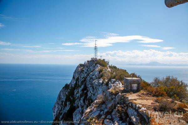
And finally we are at the very top of the Rock. View to the north. The Rock has several peaks - from the side it looks like a trident. This is the northernmost peak, behind it you can see La Linea.

The station on top of the Rock is the kingdom of monkeys, who live there completely freely. This is the only place in Europe where a population of free-living monkeys still exists. They say that as long as monkeys live in Gibraltar, it will remain English. In the 20th century, for various reasons, monkeys almost died out, and then they were given a big boost from Africa. They are quite impudent, are not afraid of people at all, and happily snatch up any objects that interest them.


From the cable car station I set off along the mountain roads to the southernmost peak of the Rock, the so-called O'Hara Battery.

South Peak

South Peak from a shorter distance
When you climb on it, the battery looks like this from behind:

And this is where the muzzle of the cannon is pointed. To the south. It is not for nothing that Gibraltar has been the key that controls the strait throughout history.

Looking down from the cannon. In the center is Africa, that is, Morocco. To the side is Spain, the Algesiras Peninsula, which protrudes more to the south, but does not have such a strategic importance because it is flat.

Inside the O'Hara Battery there are underground tunnels which were of military importance in the First and Second World Wars.

A checkpoint from the Second World War in the dungeon under the battery.

In fact, the whole of Gibraltar is riddled with tunnels. The British began building them hundreds of years ago, but most were built in the 20th century, especially during World War II. It was here that the Allied headquarters were for a time, from where Eisenhower directed the war in Africa.

The east coast of Gibraltar from the top of the peak.

Another incredible attraction of Gibraltar is the so-called Cave of St. Michael. This is a huge complex of caves inside the Rock. In ancient times, it was even believed that the cave corridors led to Africa. I was recently in the amazing caves in Sardinia, but even I was very impressed by this complex of caves - here it is very inventively illuminated with constantly changing colored light. In addition, here the caves are used in a completely different way - for example, as a concert hall!


Fantastic!

As you go down, at a certain point you come to another battery. This is a base for monkeys - its second name is Ape's Den, that is, Monkey Dwelling. I did not go down into the enclosure itself.

Another notable place is the Great Siege Tunnels. These tunnels were built during the fourteenth and final siege of Gibraltar, which took place in 1789-1793. Gibraltar was besieged by the combined forces of France and Spain. Despite the length and cruelty of the siege, they were unable to take Gibraltar. This tunnel in the northern part of the Rock was built to control the east of the isthmus, where otherwise a "blind spot" would have formed, where the cannonballs of the defending English cannons could not reach. The tunnel is simply enormous - it takes about an hour to go through it from start to finish! This is its main point - almost at the very end - for which all the construction was started. Numerous cannons were installed in this cave, which now completely controlled the isthmus.

And this is the very end of the tunnel - it comes out in the eastern wall. The soldiers are a dummy that allows you to imagine what this place looked like during World War II.

Source: travel.ru